
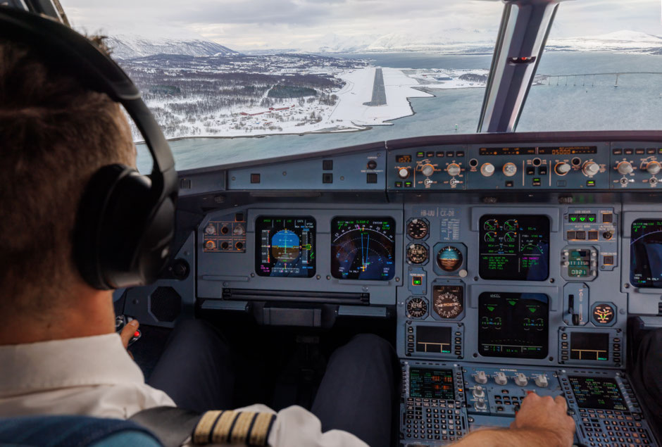
In the cockpit of this Edelweiss Airbus A320, absolute concentration prevails. The surreal winter landscape of the far north welcomes us as we line up for the final approach to runway 19 in Tromsø, Norway. Nestled within a breathtaking fjord landscape, surrounded by towering mountains and often shaped by harsh winter weather, this approach north of the Arctic Circle demands the utmost precision and seamless teamwork from the pilots. Operating so far north also brings unique challenges – from rapidly changing winter conditions to strong winds and magnetic variations that subtly affects navigation.
(Not) Just Another Day at the Office
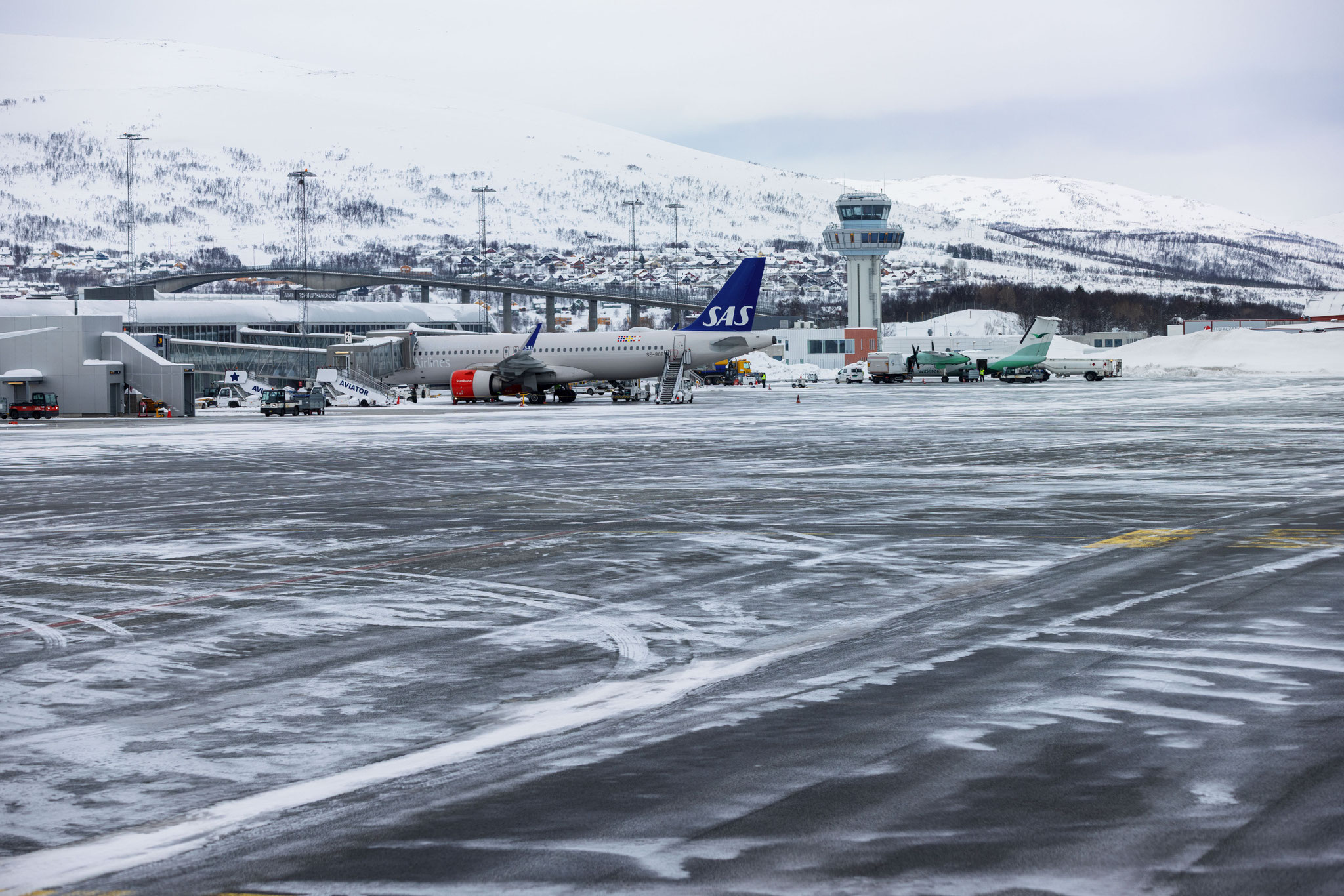
The briefing package for today’s flight is thicker than usual. Not in terms of pages, but in terms of what it demands from today’s crew. Luckily, nowadays flight briefings are conducted entirely digitally, helping to keep the pilots’ bags a little lighter and allowing us to comb through the almost endless amount of information a bit more efficiently. While the pilots are briefing, I make my way through the terminal as I get to enjoy the flight as a passenger, on my way to a vacation on Senja. The destination printed on my boarding pass reads TOS or, for those less familiar with IATA codes, Tromsø Airport. It is the capital of Northern Norway and the place where the Arctic Ocean, the fjords and the mountains converge in a landscape so dramatic it almost feels fictional. As we push back from the gate and the engines spool up, today’s flight demands the full focus of the flight crew. This is not a flight to a familiar European hub. This is a flight north of the Arctic Circle, a destination where nature writes the rules, and we follow them to the letter.
My colleagues at Edelweiss operate a broad route portfolio that takes them to the sun-drenched shores of the Mediterranean during summer and to the frozen extremities of the Nordic world in winter. Destinations like Tromsø are among the most rewarding in their network, precisely because they are demanding from an aviators standpoint and offer fantastic vistas. The combination of extreme winter weather, challenging terrain, complex instrument approaches and the unique physics of high-latitude flying means that every leg to the far north calls for an extra layer of preparation and discipline to maintain a high level of situational awareness.
The Challenges of Flying Beyond the Arctic Circle
The further north you fly, the more nature asserts itself. What follows is not a collection of abstract technical facts, but the very realities that require our attention from the moment we study the weather charts to the moment the wheels lift off again from a destination beyond the Arctic Circle.
De-Icing
If you have ever watched your aircraft being sprayed with what looks like steaming orange liquid before departure in winter, you have witnessed one of aviation’s most critical safety procedures. Accumulated ice, frost or residual snow fundamentally alter the aerodynamic shape of the wing and tail surfaces. Even a thin, barely visible layer of ice on the upper wing surface can dramatically reduce lift and increase drag. An unacceptable condition at any stage of flight, but especially critical at takeoff.
The de-icing process typically begins once ground handling activities are complete, and is performed either at the parking position as a so-called “on-stand de-icing,” or during taxi-out to the departure runway at a designated area as a so-called “remote de-icing.” The actual process is the same in both cases and can involve up to two steps, most easily distinguished by the colour of the heated glycol-based fluid applied. The first step, usually that unmistakable bright orange, removes existing contamination. If precipitation is still occurring, a second application of green anti-icing fluid follows to protect the surfaces for a defined period against renewed accumulation. The “Holdover Time” is a carefully calculated window, derived from tables in our operational documentation, during which the applied fluid continues to protect the aircraft. Once that window expires, we must either be airborne or repeat the process. Especially on a harsh winter’s day, de-icing is a race against the weather and time.

Contaminated Runways
A winter runway is not just a matter of aesthetics. Snow, slush, ice or standing water on the runway surface significantly reduce the friction available for braking, extending the stopping distance and complicating directional control during the landing or takeoff roll. The term “contaminated runway” has a precise technical meaning in commercial aviation: a surface that is neither dry nor wet, but covered with any of the above mentioned substances beyond defined extent.
Airport ground crews work around the clock in these conditions, clearing surfaces with snow ploughs and treating them with de-icing chemicals. But at destinations with persistent snowfall and sub-zero temperatures, complete clearance is not always achievable. Our performance calculations account for every variation of contamination and give us operating limits in terms of acceptable contamination depth and crosswind. We are therefore required to compute every takeoff and landing to verify that the prevailing conditions allow our aircraft, at its current weight, to operate safely. The software provides precise figures on how long the aircraft will take to stop during landing, what thrust is required to accelerate and lift off safely, and how much runway remains in the unlikely event of a rejected takeoff. Every figure is verified and taken into consideration before we move.
Cold Temperature Corrections
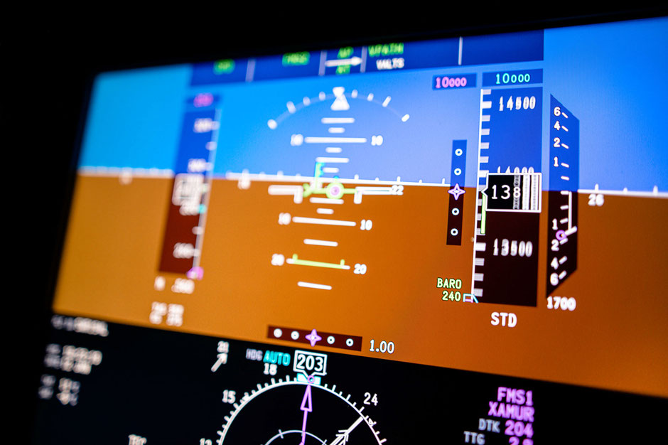
Beyond the challenges that cold weather poses during departure and arrival, it also affects one of our essential flight instruments while airborne: the altimeter. Simply put, this instrument is a pressure gauge that measures surrounding air pressure, calibrated against a standard atmospheric model. We calibrate it before each flight and at various stages throughout, synchronising it with the air pressure at the airport we are operating from or to, in order to indicate the correct altitude above mean sea level. The problem is that cold air is denser than the model assumes, and this discrepancy introduces a systematic error: in very cold temperatures, the altimeter overreads and tells us we are higher than we actually are, bringing us closer to terrain or, in the worst case, contributing to a controlled flight into terrain (CFIT).
For much of aviation history, pilots memorised the rhyme that captures this reality precisely: “From warm to cold, you won’t get old.” Today, we apply calculated temperature corrections to our approach altitudes and minimum descent heights whenever the outside temperature falls significantly below standard. As a rule of thumb, approximately 4% must be added per 10°C of cold deviation. At Arctic destinations in deep winter, corrections of several 100 feet or more are not uncommon. These corrections are mandatory, precisely verified and non-negotiable simply because the terrain around airports like Tromsø does not forgive optimistic altimetry.

Magnetic Variation and Compass Errors
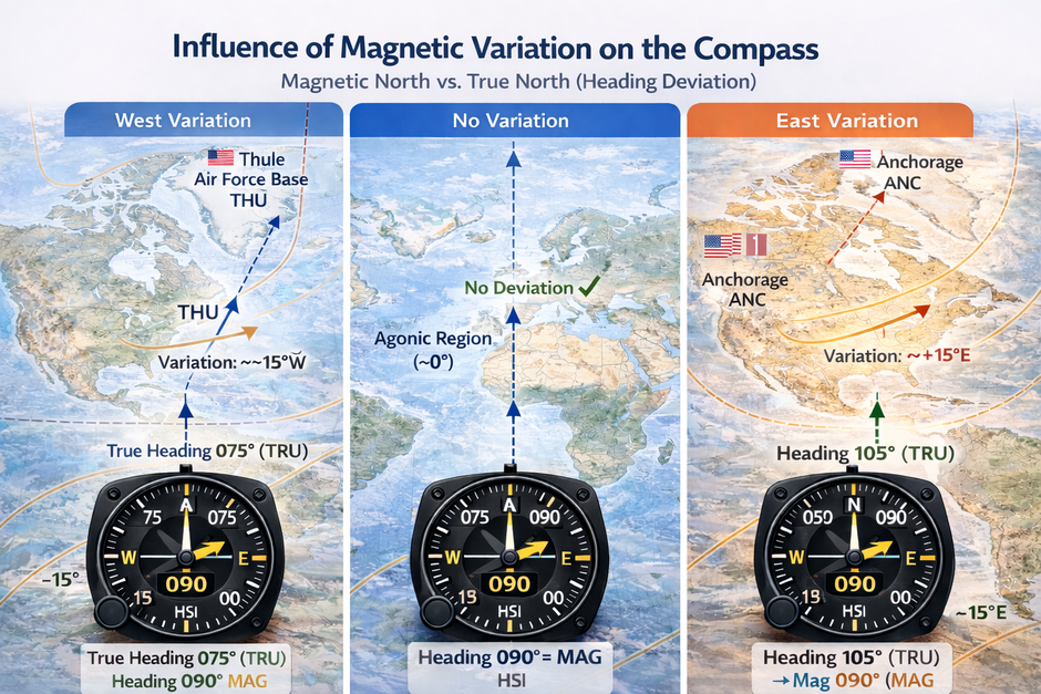
Navigation at high latitudes introduces yet another layer of complexity. The Earth’s magnetic north pole does not coincide with its geographic north pole.It sits to the north of Canada, and it drifts. The angular difference between magnetic north, which is measured and indicated by our compass, and true north at any given position is called variation, and it is printed on every aviation chart. For instance at Thule Air Base in Greenland, the variation is as significant as 42° West. At our today’s destination Tromsø, it remains significant enough to be taken into our considerations.
Beyond variation, the geometry of Earth’s magnetic field at very high latitudes causes the field lines to angle steeply downward rather than running horizontally. A conventional magnetic compass depends on horizontal field components to align itself – and close to the pole, those components become weak and unreliable. Modern airliners address this with inertial reference systems and GPS-based navigation, which deliver accurate heading and position data independent of the magnetic field. The compass remains on board as a backup, but this far north, it is our digital navigation systems that guide us with confidence.
The Approach at Tromsø – Precision in a Fjord
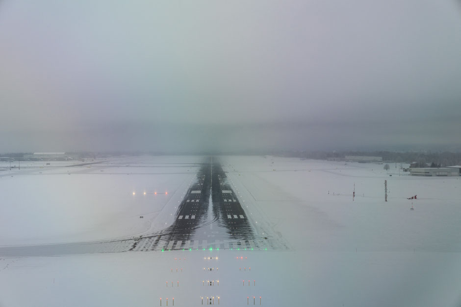
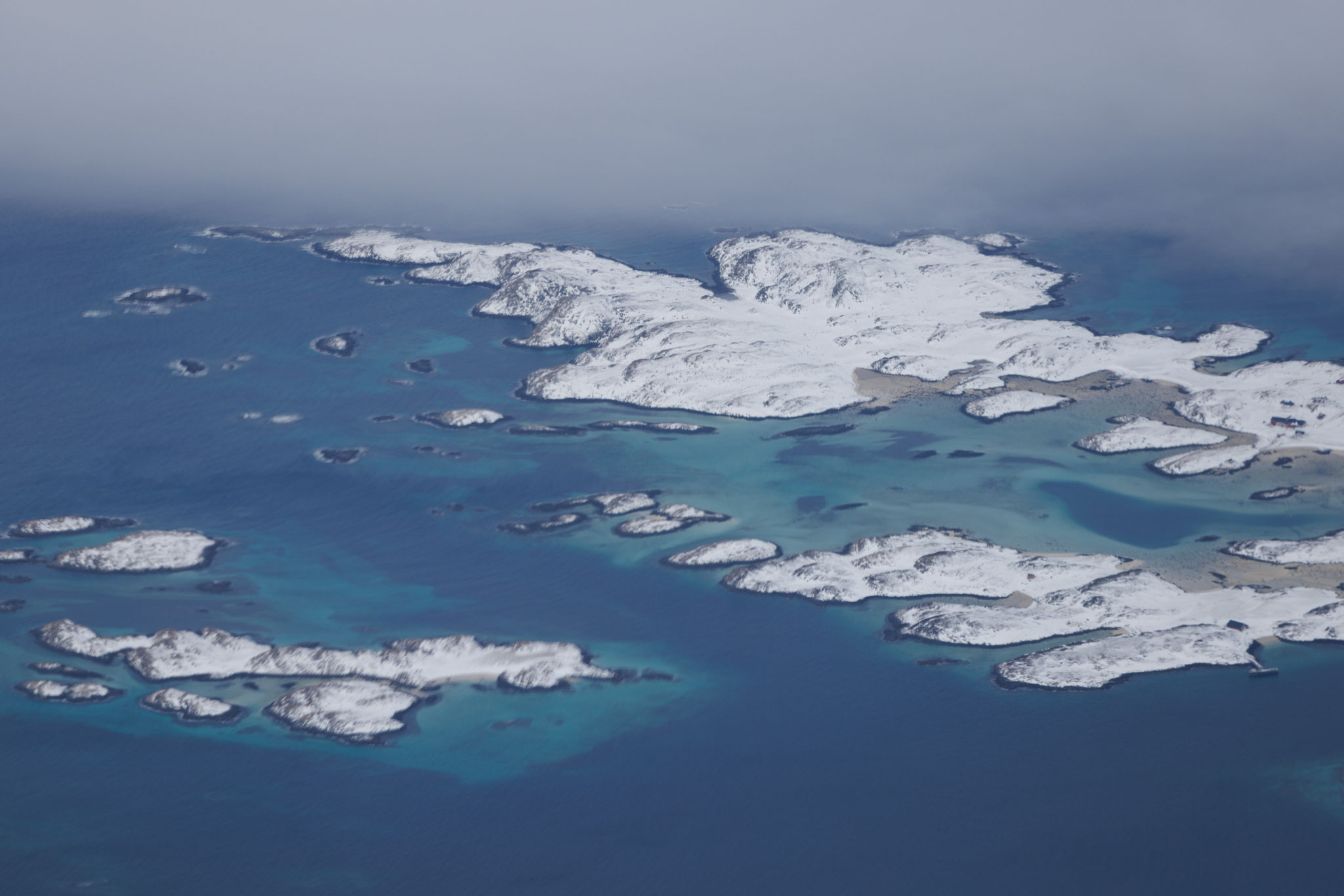
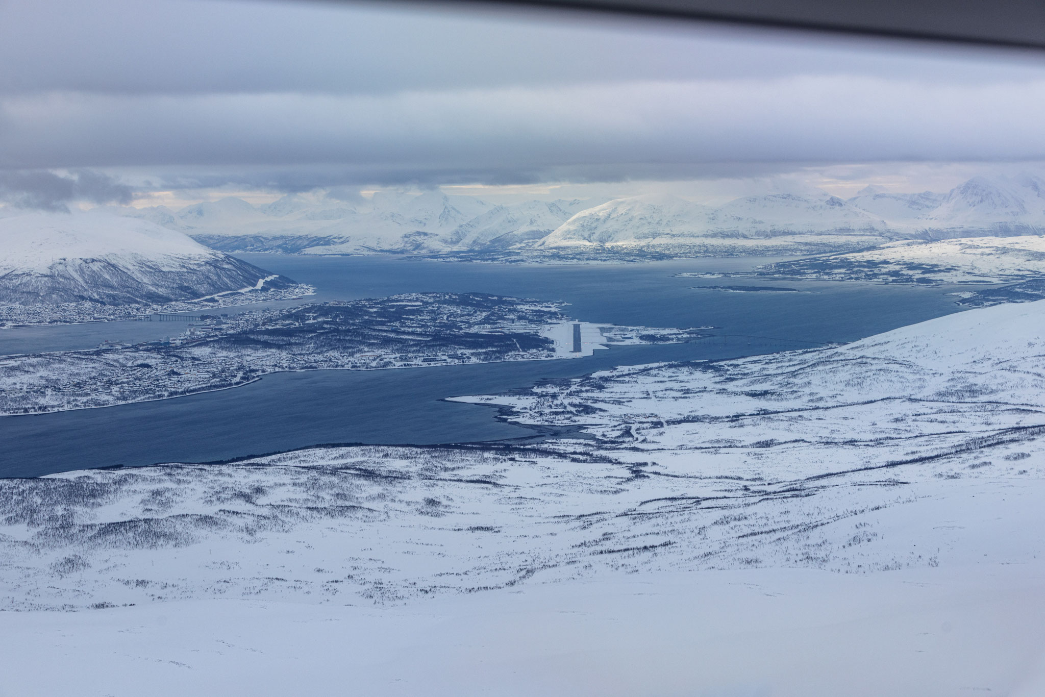
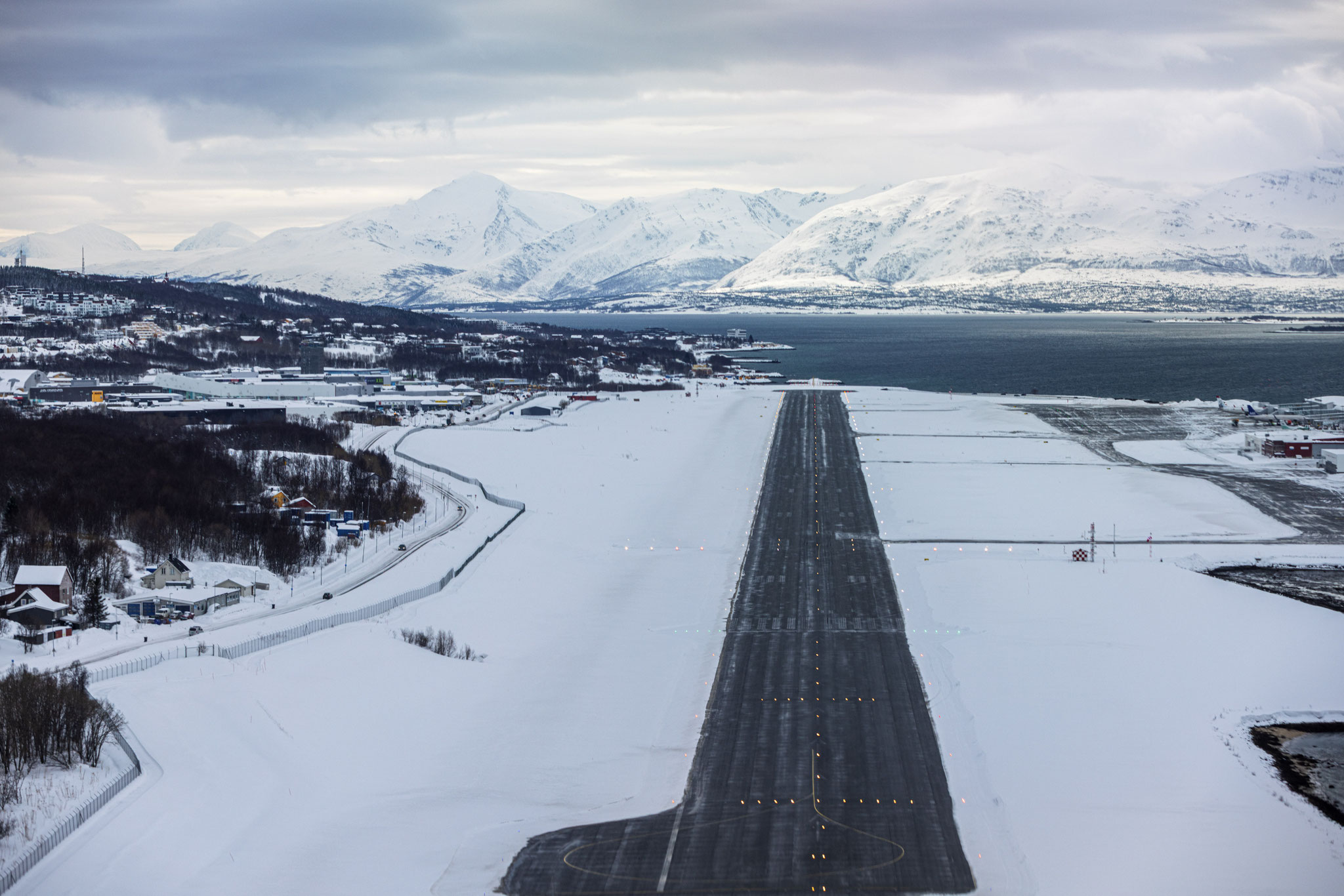
And then there is the approach itself. Tromsø Airport sits on the island of Tromsøya, pinched between the Norwegian mainland and the island of Kvaløya, at 69°41’ North, well beyond the Arctic Circle. The runway, at 2,252 metres, is shorter than what crews encounter at most major European airports, leaving a narrower margin in the performance calculation under winter conditions. But it is the surrounding terrain that truly defines this approach.
Mountains rise on all sides. The fjord landscape that makes Tromsø one of the most spectacular places on Earth to fly in good weather becomes a formidable obstacle environment on a low-visibility day. The instrument approach to runway 19, the southerly direction captured in the image, offers either an ILS or RNAV procedure, threading the aircraft down between those peaks and towards the threshold. In order to clear the terrain obstacles surrounding the airport the approach path is designed one degree steeper than the standard 3° glidepath,thus demanding a slightly higher descent rate and earlier configuration changes to allow the aircraft to slow to its landing speed in time. The steeper approach angle also creates a subtle visual illusion when the runway finally emerges from cloud or haze, as the visual picture arrives at an angle the pilots eye is not quite accustomed to.
Add to this the potential for strong and gusty winds channelled by the fjord topography, rapidly shifting winter weather and low cloud bases that can change within minutes, and the full picture comes into focus: This is an approach that rewards thorough preparation and leaves no room for complacency.


Welcome to the 69th Parallel
Both pilots are fully engaged. Checklists are complete. Energy and trajectory are precisely managed. The autopilot has been disengaged, and attention is absolute. The moment the runway emerges from the grey is one of the most satisfying in aviation. The town of Tromsø below us to our left, the dark water of the sound on either side of the island, the white flanks of the mountains materialising out of the murk. Exactly as demanding as the briefing promised – and exactly as beautiful.
Those who have never been this far north often describe the light as strange. They are right. In the depths of winter, Tromsø experiences the polar night, those weeks when the sun never clears the horizon and the world exists in a perpetual blue dusk. During my visit, a pale amber glow lingered on the southern horizon for an hour or two, the sun tracing a shallow arc below the mountain ridges without ever rising. The snow-covered peaks catch this light and hold it, glowing softly against a sky the colour of old pewter.
On the approach, the city of Tromsø spreads across its island below us. The largest urban centre north of the Arctic Circle in Norway, known as the “Paris of the North” by those who have clearly fallen in love with its vivid cultural life against such an improbable backdrop. The cathedral spire catches the last of the afternoon light. The bridge arcing over the sound to the mainland is briefly visible before the final approach demands all attention forward.
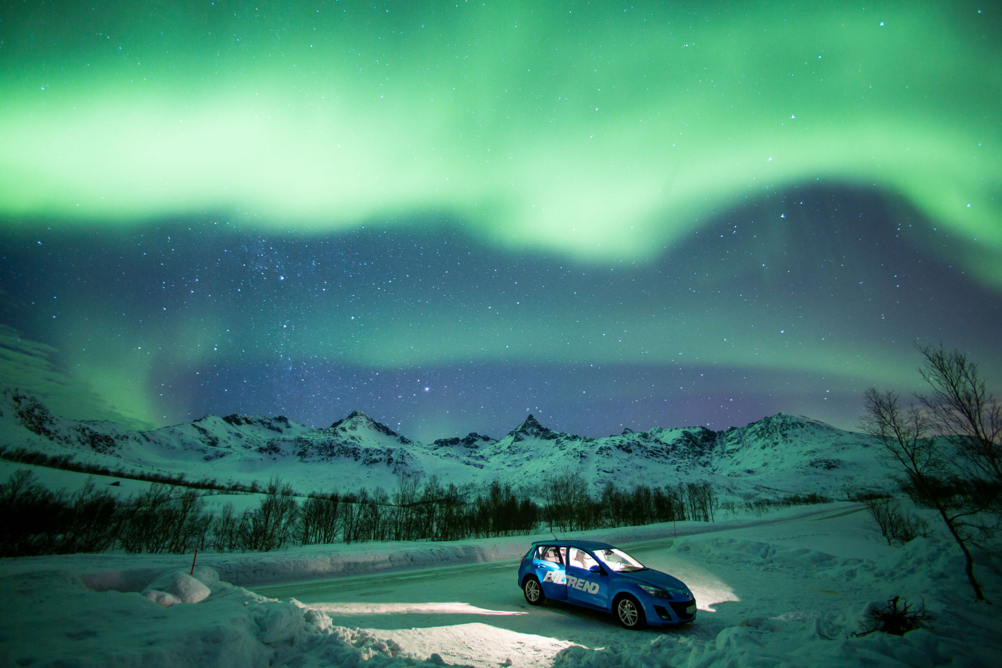
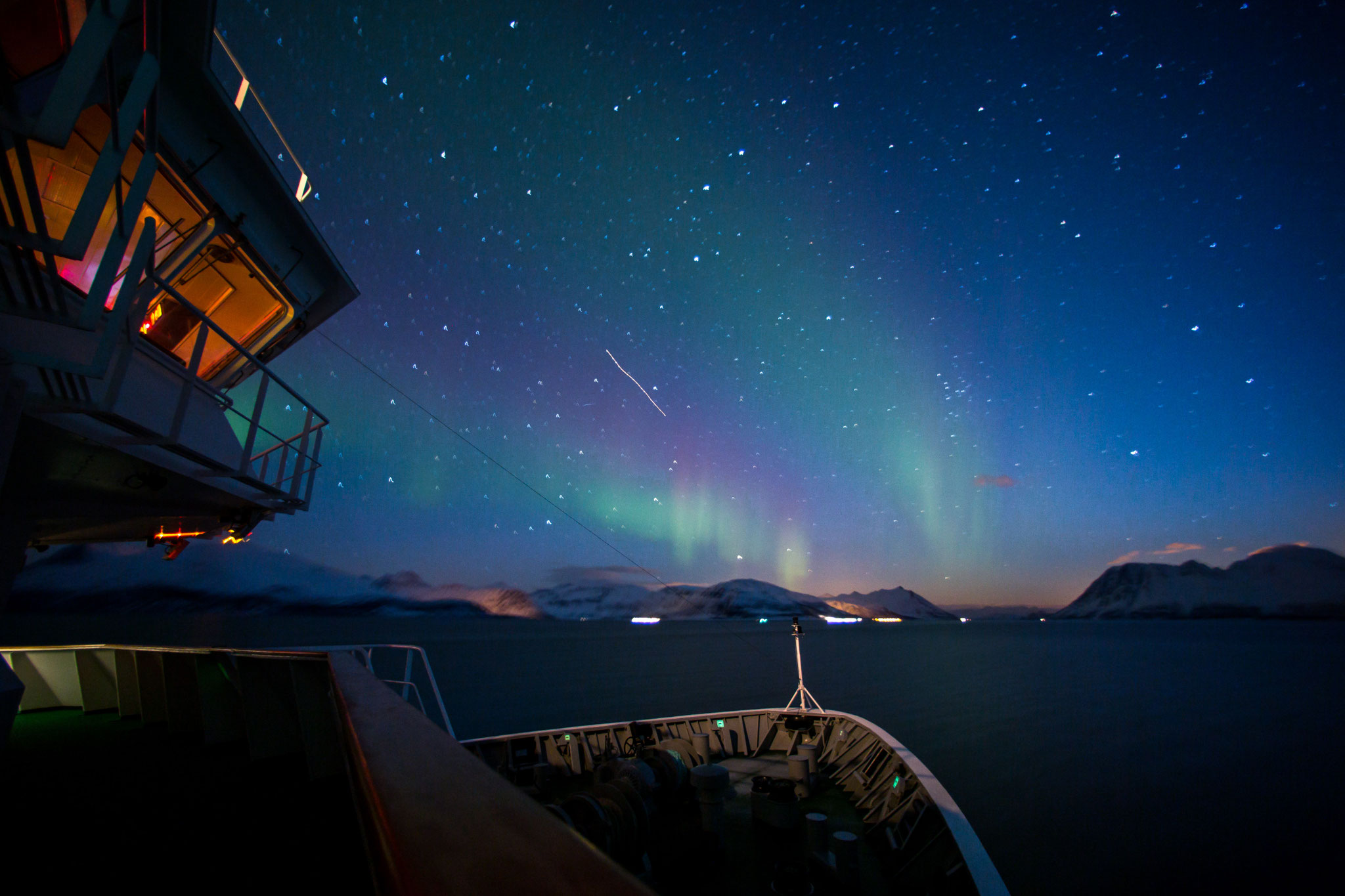
Tromsø offers something that draws visitors from around the world: the Northern Lights. On a clear night at this latitude, the aurora borealis might dance above the city with an intensity and frequency that no photograph, and certainly no description, can fully do justice to. It is one of those rare natural phenomena that insists on being experienced in person. If you are curious to see how it looks from the flight deck, make sure to follow my friend Erlend. He flies the mighty Dash 8 for a local airline out of TOS and regularly shares captivating content of green and violet curtains rippling across the sky. His content is a constant reminder of exactly why this job is a privilege. Follow him on Instagram or YouTube.


About the Image
The February image was taken in the final moments of the approach to runway 19 in Tromsø, capturing the concentrated atmosphere of an Arctic instrument approach from the jump seat of the Edelweiss A320 cockpit. The framing deliberately places both pilots in context – the surreal winter landscape filling the windscreen beyond, while the crew remains entirely focused on the final approach ahead. Tromsø is a demanding destination that requires additional type-specific training, and at some airlines it is a captain’s-only approach, meaning only the PIC is permitted to be at the controls for the landing. That additional layer of operational weight is almost tangible in the image. The low-angle winter light and the snow-covered terrain create a natural contrast with the warm glow of the instrument panel, lending the scene a sense of deep immersion in that borderland between the ordered world of the flight deck and the wild indifference of the Arctic outside.
Shot on a Canon EOS R5 with a 15–35mm lens at f11, ISO 200, 1/80sec.
About "Behind the Image"
In my photo calendar "Up in the Sky" I get to share my favorite aviation pictures with you. This blog series will complement the product and will tell the story about the moment the picture was taken. It will also share comprehensive information about what happend on the flight deck and how the picture was created.
Kommentar schreiben